La Niña Could Mean Warmer, Dryer Winter
A “slowly-developing” La Niña is approaching just as fall weather returns to the DMV this weekend.
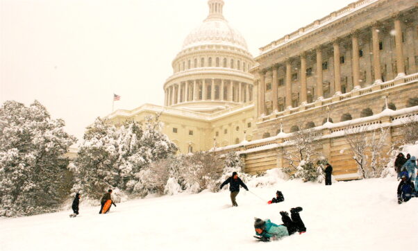
A warmer, dryer winter is forecast for the DMV this year. (Photo: Val H/Flickr)
La Niña is characterized by cooler-than-normal ocean temperatures in the Pacific Ocean, which typically leads to drier and warmer conditions in the southern tier and cooler, wetter weather in the northern tier of the continental U.S.
Above average temperatures: NOAA
The La Niña signals a warmer winter for the area, according to the National Oceanic and Atmospheric Administration’s Climate Prediction Center. It is expected to last until sometime between January and March.
La Niñas typically occur every 3-7 years. When one does, the weather pattern shifts storms northward during winter, resulting in drier conditions and warmer temperatures for the DMV. That means less snowfall and rain.
“The official winter outlook shows there’s a 40-50 percent chance of above average temperatures for the D.C. area,” said Michelle L’Heureux, a physical scientist at the NWS Climate Prediction Center and an expert on El Niño-Southern Oscillation. “But that doesn’t just take into account La Niña. We’re also seeing the impact of climate change trends here.”
While La Niña is predicted to be weak this year, the weather pattern will still feel slightly different in the upcoming months. During previous winters with a La Niña, the average temperature was about 1 degree above average and snowfall was 3-4 inches below normal. Based on this year’s NOAA Climate Winter Outlook, La Niña is expected to be weak and short-lived, but still might stand in the way of a snow day.
“Historically, La Niña is not promising for snowfall in the D.C. area,” said L’Heureux. “If you look at the past nine La Niña winters in D.C., going back to the 1950s, most of them have below average snowfall.”
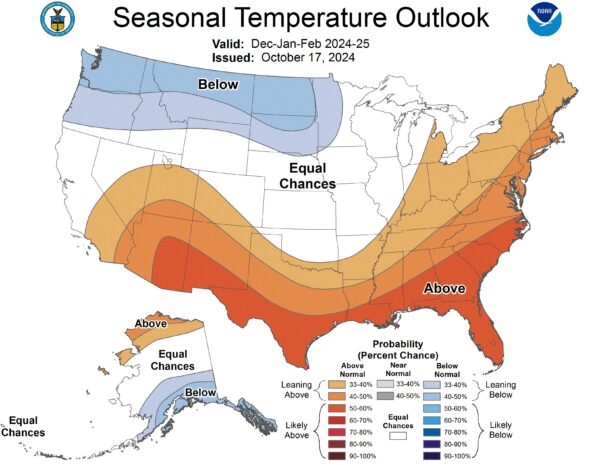
NOAA is predicting a 40-50 percent chance of warmer weather in the DMV from December through March. (Map: NOAA)
Not so rough and tough: Old Farmer’s Almanac
The Old Farmer’s Almanac says its centuries-old formula for predicting the winter uses a mix of solar science and the study of sunspots, climatology and meteorology.
“This winter, temperatures will be up and snowfall down throughout most of the United States,” Carol Connare, the Old Farmer’s Almanac’s editor-in-chief, wrote in a news release announcing its winter prognostication. “While there will still be plenty of chilly temperatures and snow for most slopes, the high heating costs associated with the season shouldn’t hit so hard. We’re predicting a temperate, uneventful winter – potentially a welcome reprieve from the extremes of recent years.”
It is especially true in the interior Northeast, where it predicts a “gentler-than-normal season” that’s “not so rough and tough.”
For the Interstate 95 corridor, which includes the DMV, snowfall is predicted to be below average in the North but above average in the South, with the coldest temperatures in early and late January and late February.
Here in the DMV, their forecast calls for a mild and wet winter in D.C. and Maryland, while eastern parts of Virginia could be colder than average with more snow.
“Winter temperatures (in the DMV) will be above normal, with precipitation slightly below normal. Snowfall will be below normal in the north and above normal in the south,” according to its area forecast. “The coldest periods will be in mid-December, early and late January, and late February, with the most snow arriving in late December and late February.”